an exercise in orienteering...
Step 1. Find the direction (azimuth) to look. Use Google maps to find the latitude and longitude of your location and the location that you're looking towards. e.g., Wallops Island VA: 37.854885, -75.4812.42. Use https://www.fcc.gov/media/radio/distance-and-azimuths to find the azimuth between your location and the location that you're looking towards.
Step 2. In Google maps zoom in on the place that you're looking from. Find a street, building, or other features that you can see and get the latitude and longitude for two points on your "reference line" (e.g., property or fence line, street, building or line between buildings, etc.) Use https://www.fcc.gov/media/radio/distance-and-azimuths to find the azimuth of your "reference line". Subtract the azimuth in step 1 from the azimuth in step 2 for the angle between your reference line and the direction that you're looking towards.

Step 2. In Google maps zoom in on the place that you're looking from. Find a street, building, or other features that you can see and get the latitude and longitude for two points on your "reference line" (e.g., property or fence line, street, building or line between buildings, etc.) Use https://www.fcc.gov/media/radio/distance-and-azimuths to find the azimuth of your "reference line". Subtract the azimuth in step 1 from the azimuth in step 2 for the angle between your reference line and the direction that you're looking towards.

Step 3. Watch the launch livestream on NASA TV and look in the direction that you determined from the two steps above.
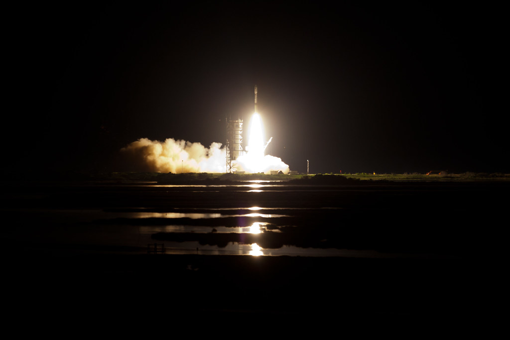
Bottom line: when the direction in which you're looking contains air traffic from Manassas Regional Airport, Reagan National and Dulles, and the object that you're trying to see is a 130 ft. high rocket 100+ miles away, it's hard to say definitively that you saw it--but, I'm saying that I did!
it was a red light--it looked like an airplane light. however, it disappeared for a minute or so, and then reappearred, seemingly farther away. since it was a clear night w/o any clouds, perhaps the disappearance and reappearance was the end of one rocket stage and the beginning of the next.
Orbital ATK's Antares Rocket Returns to Flight with Gorgeous Night Cargo Launch
No comments:
Post a Comment